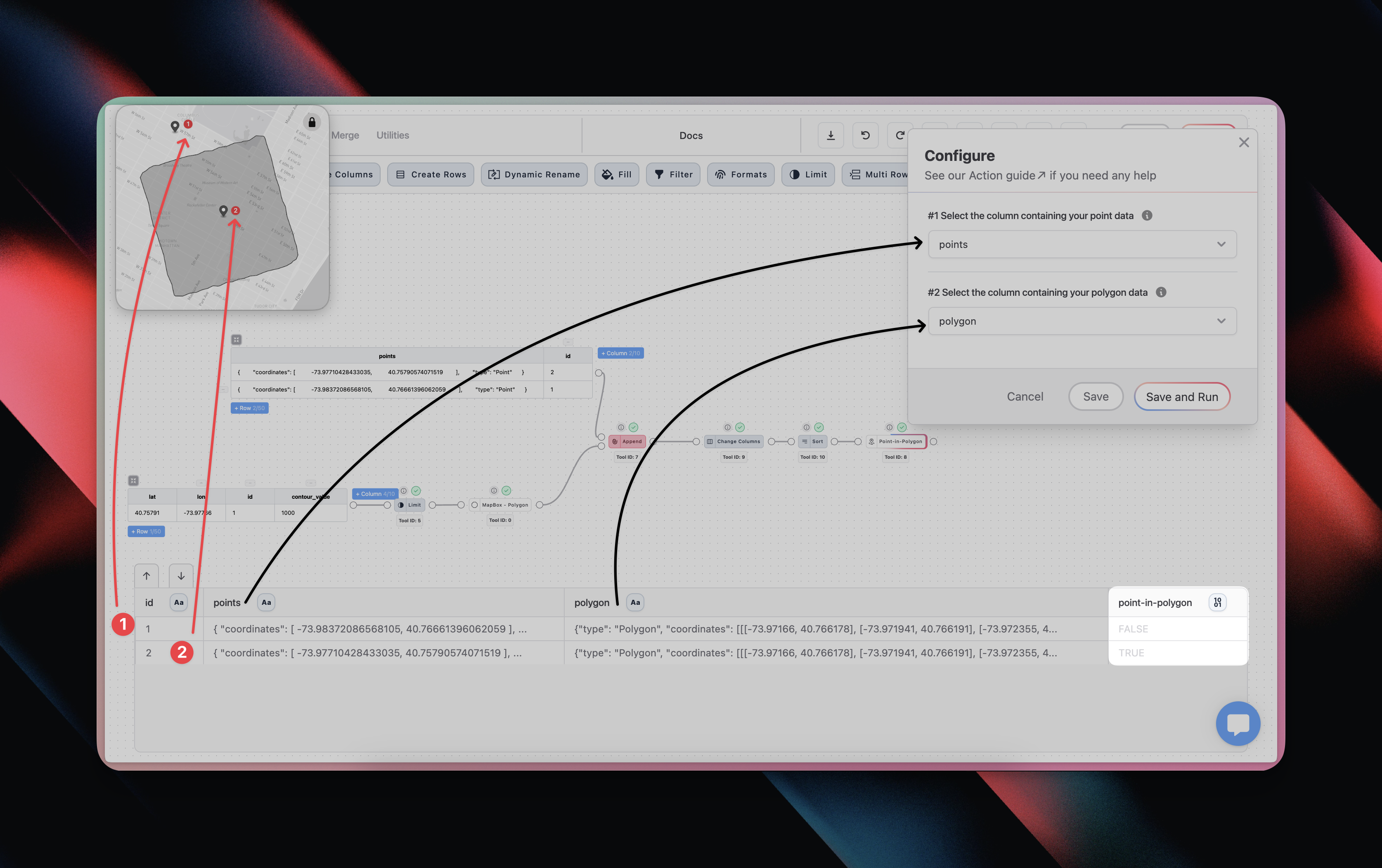
Configuration
The MapBox - Directions tool consists of seven required input.1
Select Point Column
Select the column that contains your Point(s).
2
Select Polygon Column
Select the column that contains your Polygon(s).
When To Use
The Point-in-Polygon can be used for a wide range of use cases:- You might be selecting a new warehouse location and want to check how many of your past year’s orders have been delivered within 30 minutes drivetime of each of the new warehouse options
- Check the proximity of your customers to areas of importance to you
- You could check if and how many times your vehicle fleet enters one of your location, e.g. a warehouse or supplier
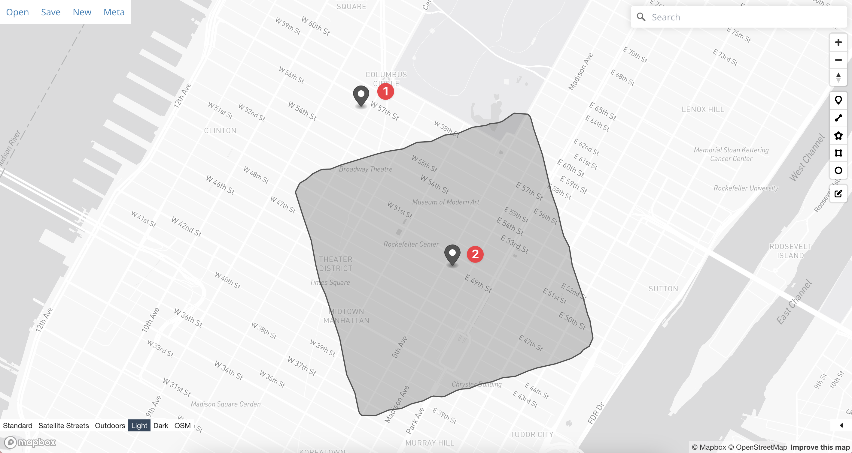
Examples
Example from illustration ☝️
Example from illustration ☝️
I want to check if my two points are inside my area column